Shop Now
- Batteries
- Boat Hardware
- Comfort
-
Electrical
- Battery Switch
- Busbars, Terminals & Insulators
- Cable Management
- Circuit Breakers
- Deck Seals
- Electrical Panels
- Electrolysis Protection
- Engine Instruments
- Fuses & Fuse Blocks
- Heat Shrink
- Horns
- Meters
- Plugs & Sockets
- Single & Multi-Core Cables
- Switches
- Terminals & Crimps
- Tank Senders
- Accessories, Upgrades & Spares
-
Marine Electronics & Raymarine
- Internet
- Antennas
- Autopilots
- Axiom Range
- Digital Switching
- Electronic Charts
- Element Series
- Fishfinder/Sonar Modules
- Instruments
- Marine AIS Devices
- Marine Cameras
- Mounting Systems
- Networking & Cables
- NMEA Converters & Sensors
- Radar
- Satellite TV
- Thermal Cameras
- Transducers
- VHF Radios
- Accessories, Upgrades & Spares
- Marine Lighting
- Power Generation & Management
- Propulsion & Around The Engine
- Pumps
- Safety Solutions
- Sanitation & Tanks
- Steering Control & Trim
- Tenders & Inflatables
- Vessel Manoeuvring Systems
- Watermakers
- Winches & Cranes
Raymarine on board to help map 100% of world’s ocean floor
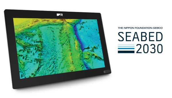
Raymarine has entered a strategic collaboration with The Nippon Foundation and GEBCO (General Bathymetric Chart of the Oceans) to support the Seabed 2030 project ¾ an ambitious global initiative to map 100% of the world’s ocean floor by 2030.
To date, only about 25% of the world’s seafloor has been mapped to modern standards. Seabed 2030 aims to close this gap by 2030 and Raymarine will be a key innovative partner in achieving this goal. Once mapped, the information will then be used to support marine conservation, climate modelling, tsunami forecasting and sustainable ocean resource management.
Launched in 2017 and an officially endorsed programme of the United Nations Decade of Ocean Science for Sustainable Development, Seabed 2030 aims to compile all available bathymetric data into a freely accessible map of the global seafloor. Raymarine’s contribution to the project is the provision of a unique dataset of crowd-sourced bathymetric recordings. This data, collected from across the globe, from thousands of vessels equipped with Raymarine sonar systems, will enhance the resolution and coverage of existing seafloor maps, particularly in under-surveyed coastal and offshore regions.
“We’re proud to support in mission to map the world’s oceans,” says Grégoire Outters, General Manager at Raymarine. “This collaboration reflects our commitment to safer navigation, better science and a more sustainable future for the maritime industry.”